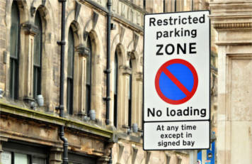
The Department for Transport (DfT) has launched a consultation on the future of Traffic Regulation Orders (TROs), which determine how councils create speed limits, allow temporary road closures or restrict parking.
The DfT is working with GeoPlace, the British Parking Association and Ordnance Survey as part of a discovery process to consider how TROs are made, and how TRO data is made available and used.
The evidence will go towards creating a free guide to 'help local authorities understand how they can work within the limits of current legislation based on best practice' and could eventually support a draft data model for TROs becoming accessible by app and in the world of connected and automated vehicles.
The purpose of this research is to:
- identify how to use the current system most effectively
- identify how we can support the transport network of the future
- produce a draft data model for the storage of all TRO data - this model will be available freely
Abbas Lokat, senior consultant at GeoPlace, said: 'Better visibility of traffic regulations and access to additional information and services can help improve the citizen experience and increase innovation around traffic control.
'We want to understand if there is a growing demand for open, machine-readable traffic regulation orders from users and developers looking to improve parking information for citizens to freight companies needing to route their fleets more effectively.'
The initial consultation ends on 21 December.
Watch the introductory video and participate in the survey at www.geoplace.co.uk/TROdiscovery.
